A Taste of Great Things to Come!
As we keenly await the opening of the full Grampians Peak Trail in 2019, one of our guest adventurers (Sambo Christie) and his Father head out to get a taste of what’s to come.
We can feel our taste buds tingling with the anticipation of the full opening of the trail. It’s just a shame we have to wait another year. In the meantime however, you can do the Wonderland Loop which is a nice little taster for what is to come.
The Grampians Peaks Trail (currently under construction) will be a 144km (13-day) hike that runs from the southernmost end of the Grampians to the northernmost.
Day One
The start of the walk is conveniently located within the Halls Gap township. You can simply park your car at the tennis courts, walk a few metres to the botanical gardens, and you’re off.
I like to think of the rusty but decorative gate to the gardens as the gateway to the Wonderland Loop. The mountains here have real character, and it’s fitting that the gate that welcomes you should also.

The gate to Halls Gap Botanical Gardens.
The gardens are lush and green, relish the fresh mountain air as it floats into your nostrils. Wonderfully sculpted boulders and tors already loom impressively beside the track. On a hot summers’ day, I could imagine this part of the track buzzing with activity as people head to Venus Baths to relax in the cool water, but while we were there it was quiet.
The Elephant Hide (named so due to its striking similarity with the skin of an Elephant) rises steeply and abruptly from the baths. It looked like so much fun.

Elephant Hide.
Highway to the Pinnacle
We kept heading up the steep rocky track, using handrails where necessary, until things started feeling familiar. Of course, we were on the tourist highway to the Pinnacle (not a literal highway, good luck getting the car up there).
It’s a tradition to go to the Pinnacle while touring the Northern Grampians, but if you don’t like crowds, you might not go back. Its beauty cannot be doubted, but the vast amount of people who walk it daily means that it’s no place for those seeking peace and serenity.
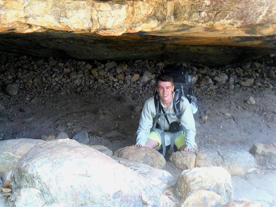
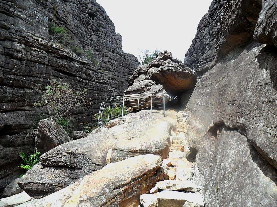
Through the picturesque Grand Canyon we went, hopping between, over and around rocks. The water that runs beside the trail was bubbling away peacefully, and the canyon was surprisingly quiet and devoid of tourists. I can only imagine what that final climb out of the Canyon would have been like before the staircase (pictured below) was installed there.


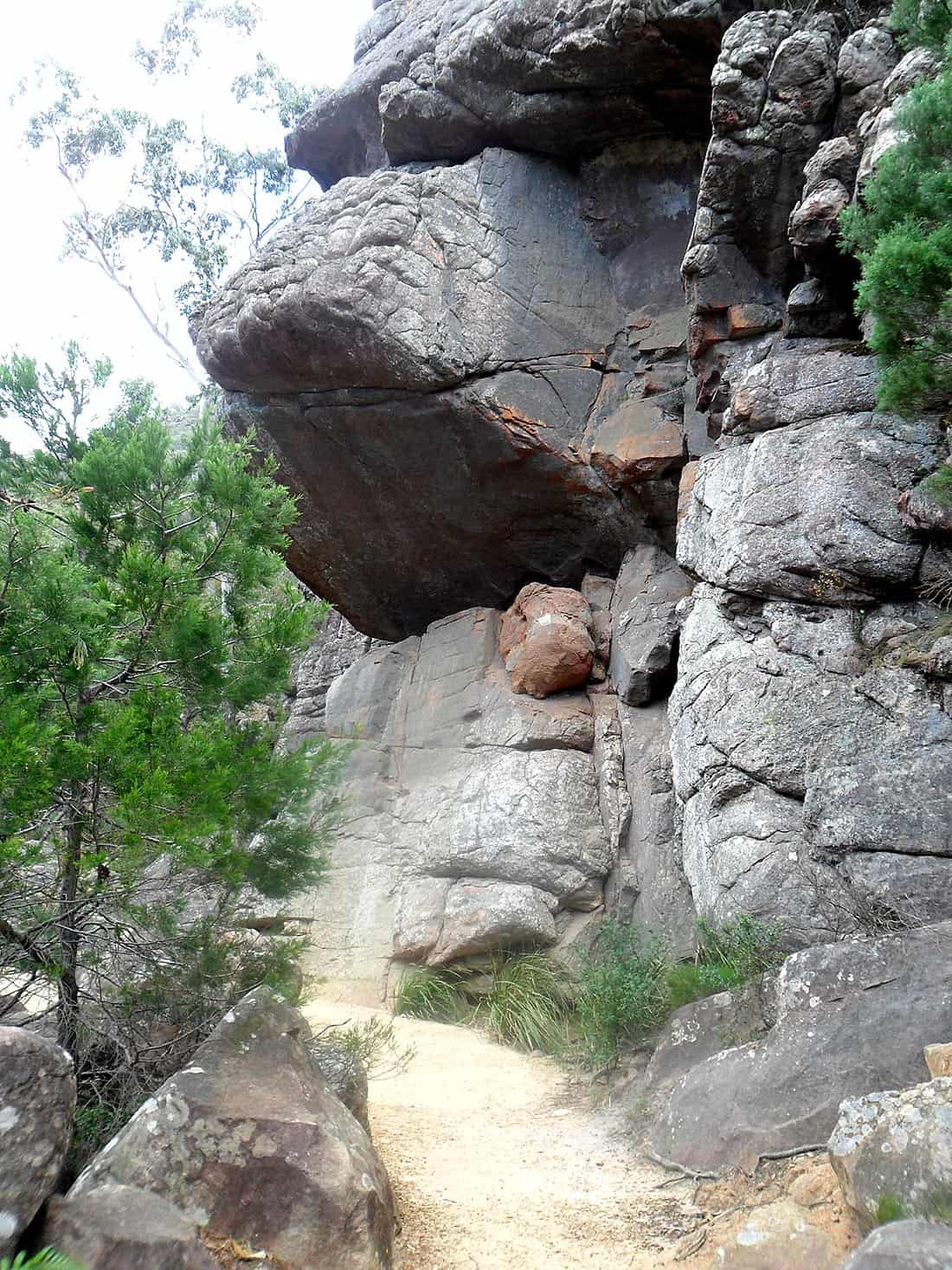
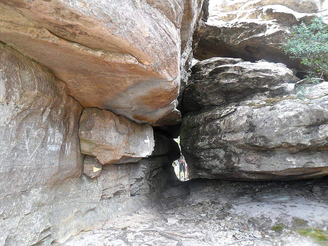
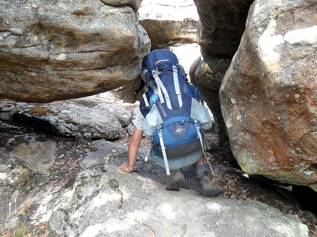
A plethora of weird and wonderful rock formations, caves and waterfalls on the trailside will keep anyone entertained. As we hopped and jumped our way through this marvelous sandstone landscape, the last point of interest pre-summit was the Silent Street, a narrow chasm that won’t induce claustrophobia but could potentially be tricky to navigate while carrying an extra-large pack.

Entering the Silent Street.

See the exit?
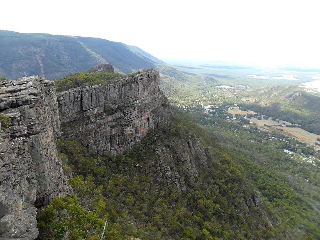
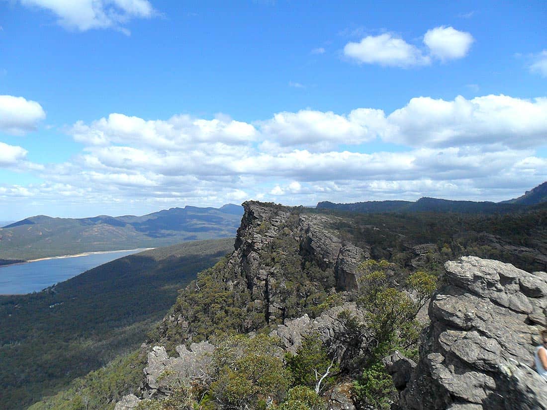
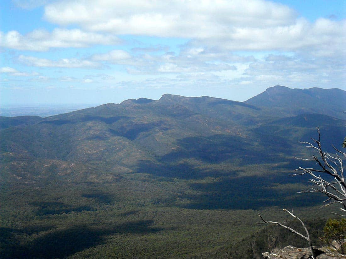
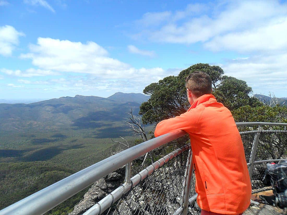
Popping out the other end of the chasm, the scenery swelled to a vast amphitheater of sandstone. Minutes later we were at the Pinnacle, hovering above the Halls Gap township. Views of the region were expansive, and the range extended alluringly to the south. It’s hard to look upon a mountain with anything but inspiration, foreknowing that you will tread upon it in days to come.


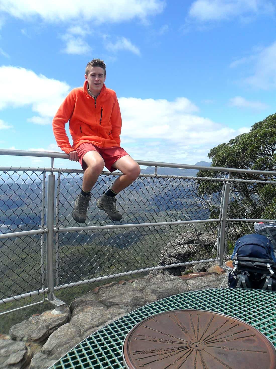
A Quick Nerve Test Before Camp
Before continuing on, I took the ‘nerve test’ for a quick thrill. The nerve test is a narrow band of rocks that protrudes from the Pinnacle. A steep drop on either side apparently makes it quite a nerve-wracking ordeal.
I remember the first time I did it, I was so scared, but in hindsight it was only due to its undeserving reputation. If you fall, you will probably break bones but you have a good chance of surviving. If you can keep your cool, balance won’t be an issue and the risk is minimal, however I don’t advise attempting it. I believe it used to be marked by a sign, but that was removed after the test caused a few too many problems.

Undertaking the nerve test.

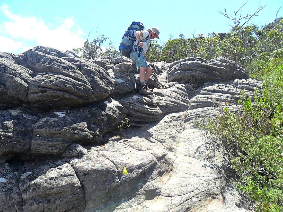
A rocky route to camp.
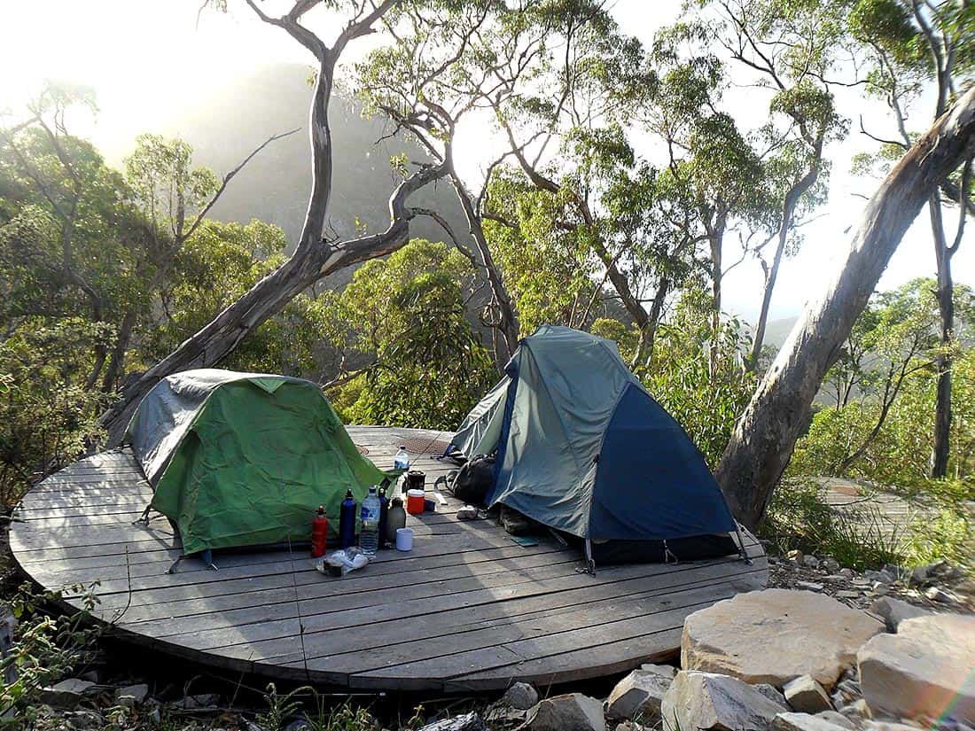
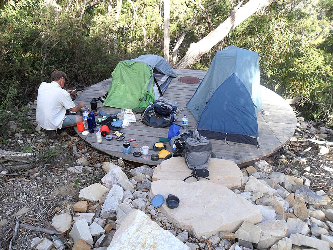
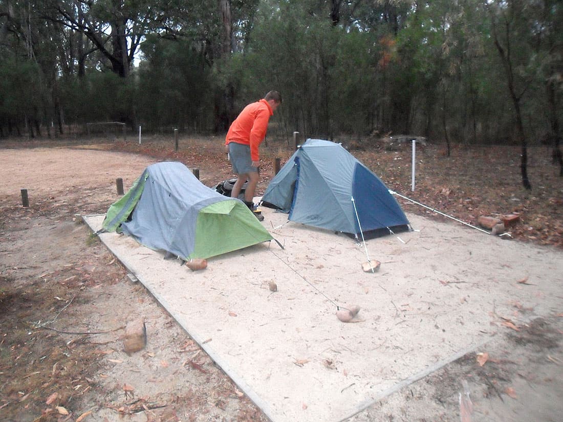
From there, the track hopped firstly along a rocky route, then wound upwards to our destination at Bugiga Hiker Camp. At first sight, it looked marvellous. Upon closer inspection, it was underwhelming. In hindsight, having stayed there, I’d say it was slightly disappointing.
The tent platforms were pretty but not practical. A single wire ran around the outside for tents to attach to. It was only upon reaching the Brambuk Cultural Centre that morning that we were advised to bring more cord. Perhaps we just didn’t know how to work it. Either way, the Tasmanians do it better. Our tents were flaccid and looked terrible.
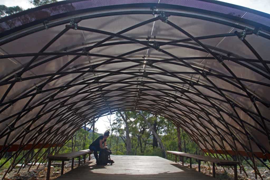
 in the background.")


The shelter apparently cost Parks Victoria (or whoever it was) a lot of money to implement. Once again, it was pretty but really not that great. It seems to be a bit of a theme at Bugiga. Open at both ends in a tunnel design, the shelter won’t keep you any warmer. Inside, two long benches on either side are the only features.
Toilets, tick. Water tank, tick. A neat view of Mount Rosea, tick.
I give Bugiga an 8/10 for presentation and location but a 5/10 for practicality. Sorry for being a whiner. Just keep the campgrounds simple and practical.
Day Two – Rosea Roaming
We woke to a sunny day of twenty-five degrees Celsius. It was a warm day for walking at ground level, but with the altitude of Mount Rosea and a slight breeze, it was perfect. Setting out from Bugiga, we shortly flanked Mount Rosea and began following the yellow marker arrows onwards and upwards.

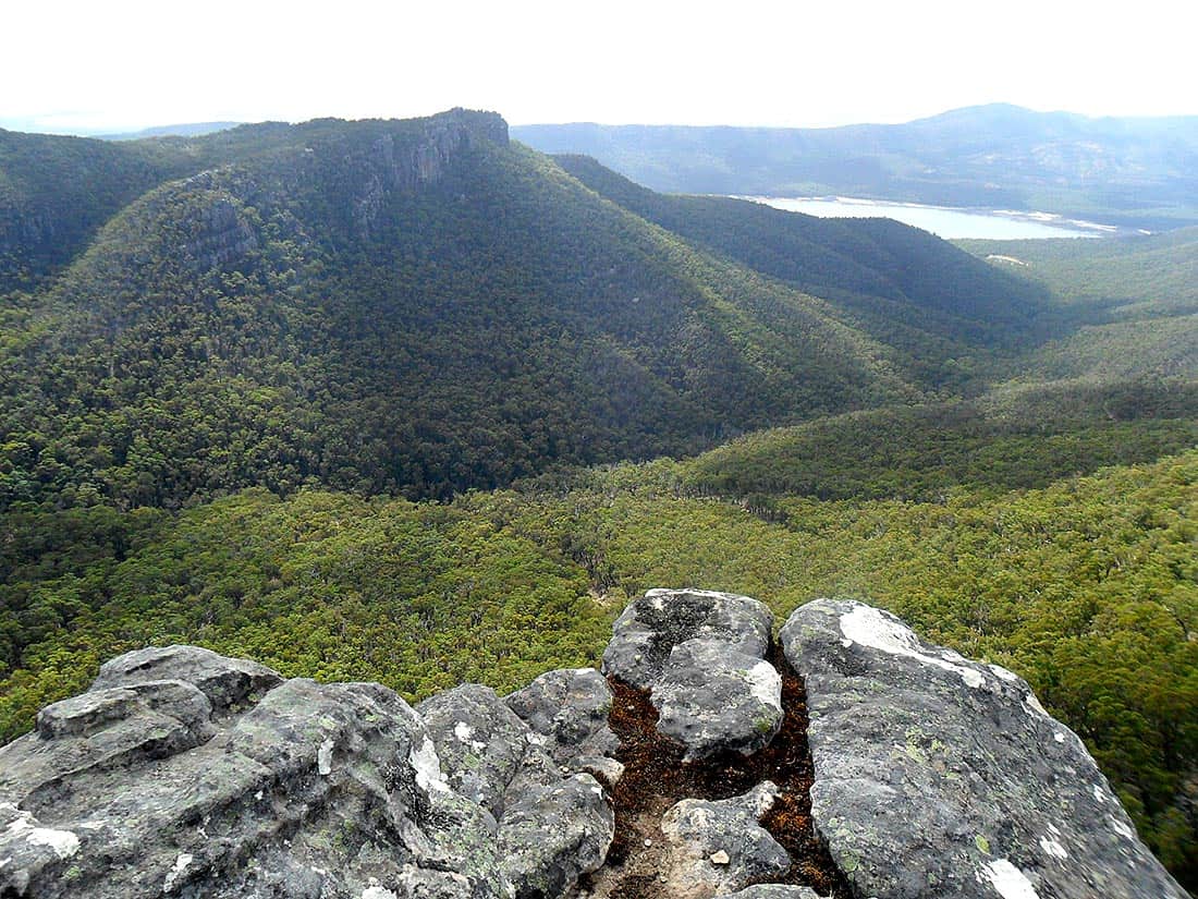
Typical Mount Rosea terrain.
We were met with a panoramic Grampians masterpiece the moment we stepped onto its craggy expanse. These views accompanied us for much of the way, eliminating any threat of a dull moment. The diversity of the climate here has gnawed and scoured the landscape into some pretty bizarre formations.
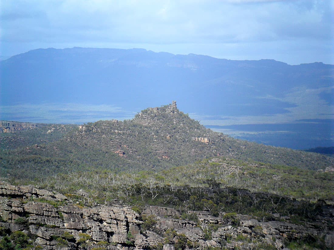
Every chunk of rock in the Grampians has its own unique impressions and shapes. The peaks do too, and some of them stand out more than others. Tower Hill to the west looks like a turret.
?")


Easy access to some neat cliff viewpoints made for a few good photographs. They could have been really good photographs with an upgrade to my little point and shoot camera. If my camera was capable of steadying for a shot at full zoom, I’d have taken a photo of the shelter at Bugiga. Yep, we saw it from all the way up there.


Windy Chasm
It was time to take on the Gate of the East Wind, a deep and deathly chasm between cliffs. One slip could cause injury or death. Fortunately, a metal bridge sat firmly over it, so there was actually no risk at all.
Maybe it took a bit of the adventure out of it. It’s another one of those situations where I wish I could have been an early explorer of this region. I don’t mind a little bit of risk and a healthy dosage of problem-solving to spice things up once in a while.

An unimpressive view of the Gate of the East Wind.

Woah, hold up there Dad. Staring into the Gate of the East Wind.
Nearing The Top
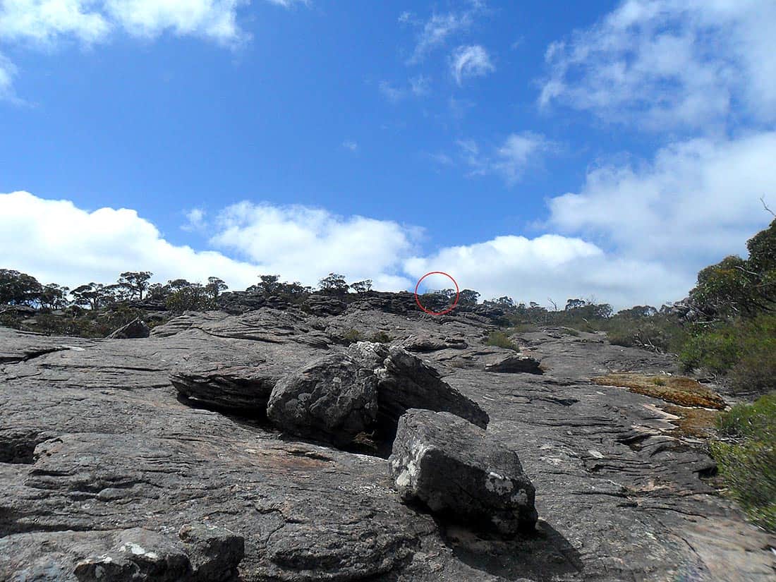
We could see the top now. It must have been getting cold at this point, as I stopped to throw on a fleece jacket. While we stopped briefly to catch our breath, I noticed something red moving in our direction.
It turns out I actually had heard voices in the chasm earlier, but it wasn’t necessarily IN the chasm (I would certainly hope not). The three ladies had picked a wonderful day to venture up Mount Rosea. Their enthusiasm for bushwalking was refreshing, and I want to be like them when I reach their age.


Camp Two
The track works its way down from Rosea, transforming from a craggy (and sometimes steep) track into a gentle sandy decline. We rested briefly at a small dry creek bed which lays nearby to Borough Huts, before powering on into camp.
Our tents were erected quickly and we relaxed in the pleasant bushland of Borough Huts Campground. We had hidden a water drop in the bushes there, and I retrieved the 5L bladder when I went to dip my feet in the cool water of the creek which (barely) runs behind the campground.


The wasps here were terrible, especially at meal times, and hounded us until the cool of the evening finally saw them disappear. A slightly more welcome guest was a friendly Kangaroo that had no qualms in getting up close and personal to us and our belongings.
He didn’t look too impressed when I stuck the camera right in his face, but then again that could just be the standard Kangaroo facial expression. He didn’t disembowel me when I reached out to pet him so I’ll assume he was somewhat comfortable with my closeness.
I’d like to add that to my list of wild (but obviously very tame) animals which I have managed to pet while in the bush. The other one was a Brushtail Possum at Kosciuszko, which I had to keep removing from our food container.

Sussing us out.

Getting closer…
Day Three – The Boring Part
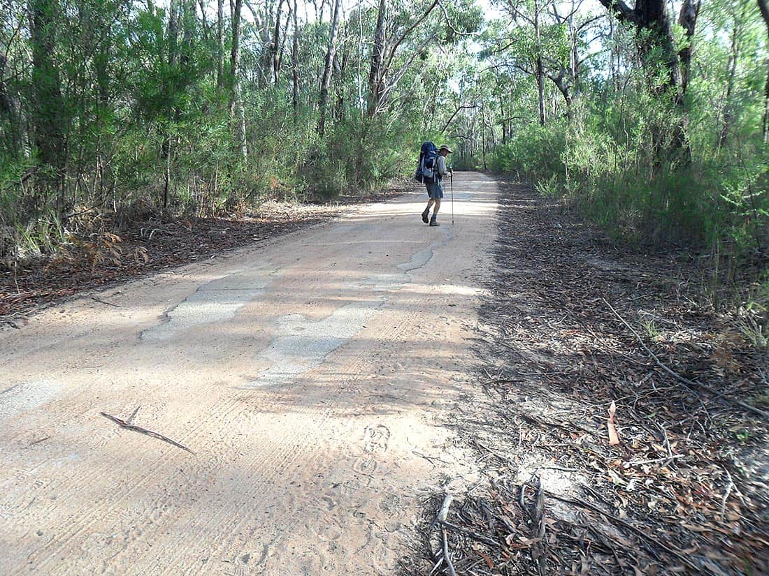
Days one and two of the loop (over the Pinnacle and Mount Rosea) will be a part of the GPT, but day three has a sole purpose of returning you to your vehicle. It’s quite a boring day of bushwalking, a relatively easy 14 kilometres, with a few steep pinches. A lot of walking is done on vehicle tracks.
The wasps were up bright and early to harass us over breakfast. After packing up, we crossed the highway outside camp and began wandering towards Lake Bellfield. A right turn took us up into the hills again on a vehicle track, annoyingly.
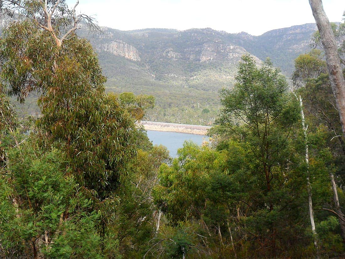
A lot of ups and downs through forest which is largely unchanging and uncharacteristically monotonous for a Grampians walk. Every now and then we would get a glimpse of Lake Bellfield, pleasantly breaking the standard dull green of nothing but trees.


Done and Dusted
We retained civilization steadily from this point onwards and it was great to soon be back in the beautiful Halls Gap. We walked to the Brambuk Cultural Centre (why drive when you can walk?), and from there back into town and to our vehicle and used the bonnet of my car as a tripod for our standard post-bushwalk snap, and thus concluded our three day adventure.
What a wonderful walk! I for one am incredibly keen for the official opening of the GPT. The Grampians are absolutely stunning. The mountains are a really homely place for an adventurous spirit to grow and thrive, and it’s no doubt jam-packed with a diverse range of challenges and experiences. The day it’s announced open, I’ll be racing off for two weeks.
Notes
Sadly, the campsites aren’t free anymore, so you’ll need to first book your campsite for both Bugiga Hiker Camp and Borough Huts Campground if you are intending to camp at these sites. The good news is that ‘dispersed camping’ is legal in many parts of the Grampians. There is a map that shows where dispersed camping is and isn’t permitted. It looks as if it is permitted to the north of Borough Huts and to the west of where Bugiga would be. The map can be downloaded from Parks Victoria.
Lastly, the third day has no bearing on what a magnificent taste of the GPT this really was. For those who want to skip the boring third day on this walk, there are options. If you have one or more companions, you could organise a car shuffle, leaving one vehicle at Borough Huts and the other in Halls Gap. Alternatively, ‘Halls Gap Tourism Shuttle Bus’ will take you from Borough Huts back to your vehicle for a cost. You can find them on Facebook here.
